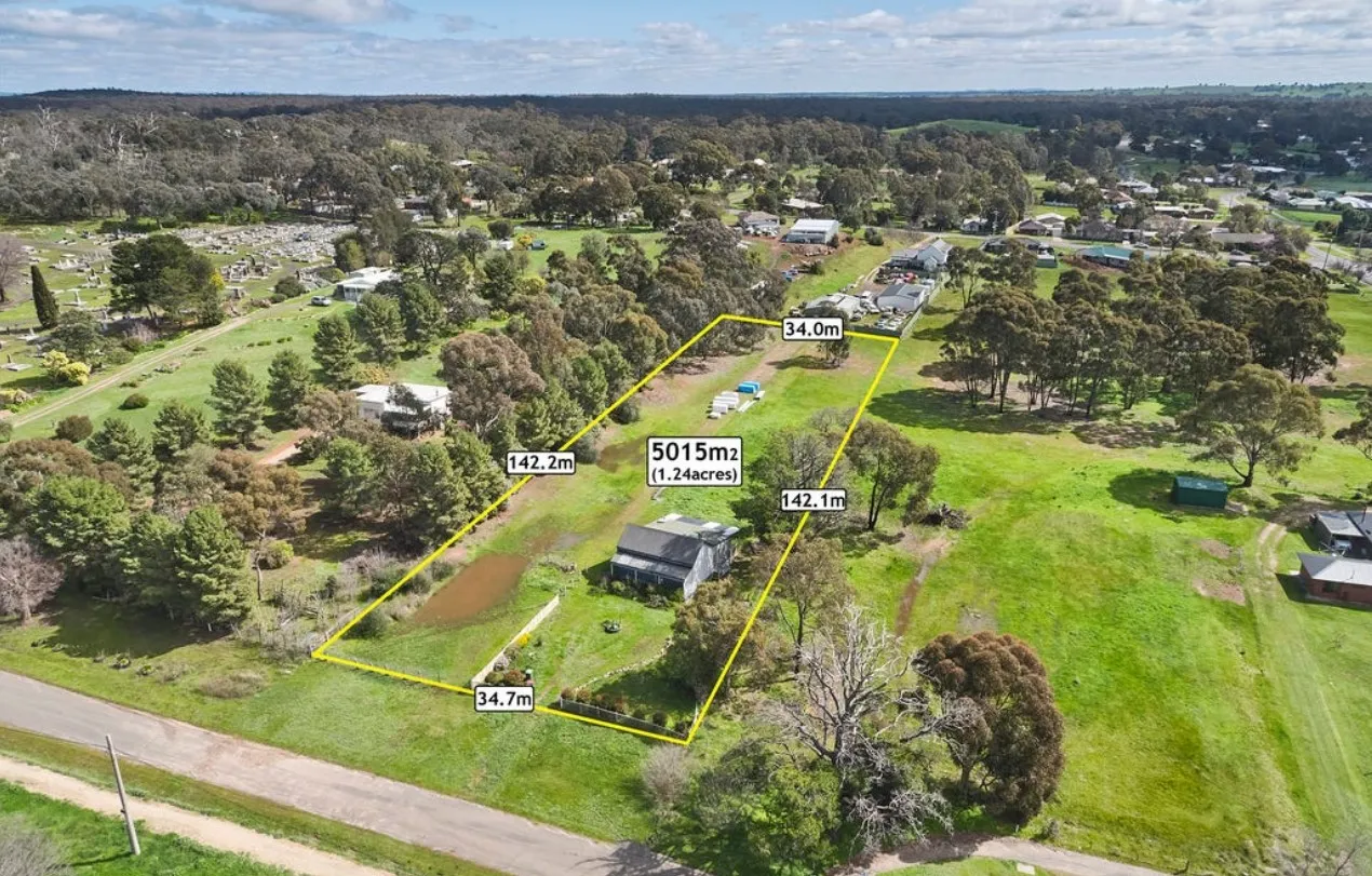
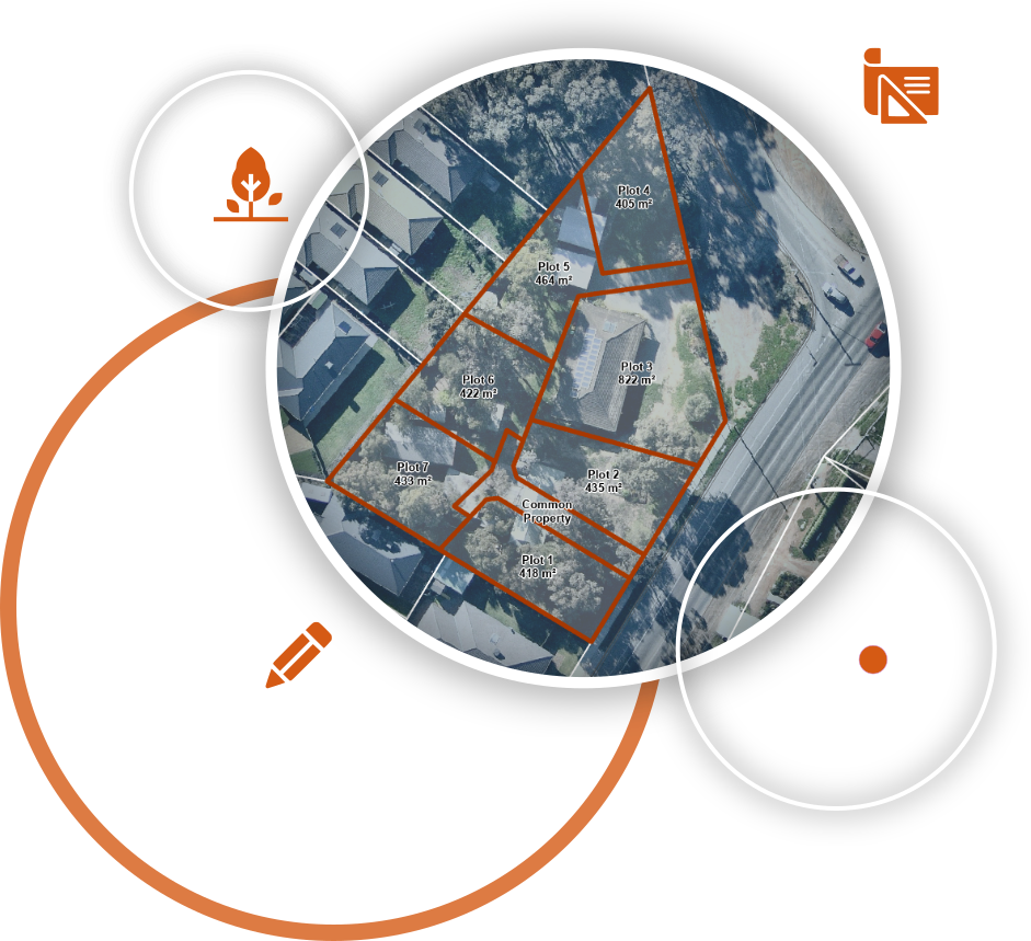
We have subdivided this land with best possible option to maximise the profit. We investigated planning controls, analysed market potentiality, discussed with local council and then designed a most suitable subdivision plan for the site. Our scope of work consists of obtaining planning permit, demolish existing structures, install utility services, construct roads and crossovers and make it available for the property market to start selling.
We have been working with Geospatial Bangladesh for several years for their various projects. Our first project was to develop a map viewer for viewing hundreds of spatial layers of Bangladesh. The layers were categorised into administrative boundary, demography, literacy, infrastructure, socio-economic parameters, climate, and natural disaster. A huge effort was given to prepare the data for the viewer, which includes collation, digitization, correction and organisation. Product features included but not limited to:
Designing a Lakemba townhouse with Revit demands precision. The 4-bedroom house integrates functionality and aesthetics, featuring detailed 2D drafts, immersive 3D views, insightful sections, and precise floor plans. Elements are meticulously crafted for optimal space utilization and a harmonious living ambiance. Client engagement is heightened with diverse design options, empowering them to select layouts aligning with their preferences and lifestyle.
Over an acre transformed, subdivided into 9 lots, this ambitious development requires detailed planning. Native vegetation removal adapts the layout. A water main easement adds complexity, demanding careful integration. For accessibility, a common property is proposed, ensuring unified access to all lots. This project demonstrates a commitment to strategic subdivision and land development.